Click the arrows at the bottom of your screen to visit each section.
1/3
Click the arrows at the bottom of your screen to visit each section.
Use the navigation bar/menu to revisit any part of the meeting.
Leave your feedback any time on our Comment Form.
The Wyoming Department of Transportation completed a study of the intersection of US 87, WY 332, and WY 335, also known as the Big Horn Y Intersection.
The study team analyzed the following:
The final report reviews the existing conditions of the intersection and provides recommendations with the goal of enhancing safety and operations of the intersection.

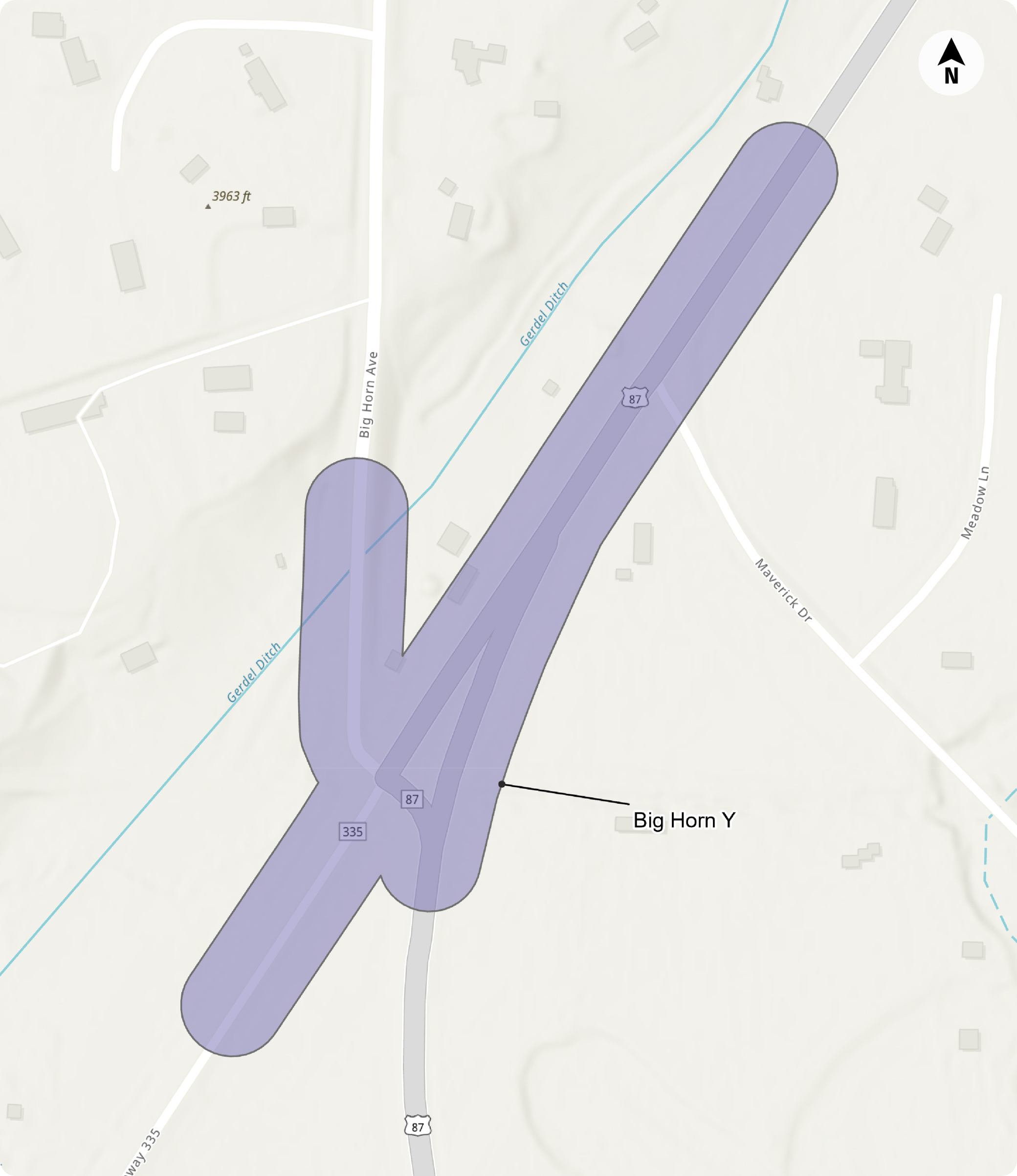
This is the second and final meeting for the US Highway 87 Intersection Study. This unique intersection, also known as the Big Horn Y, is located near Sheridan and presents challenges for commuters, trucks, bicycles, and pedestrians alike.
The goals of this meeting include:

The initial public involvement effort included an online-only public meeting in April 2024. Stakeholders and the public were asked a series of questions about intersection use and operations. Over 200 residents and frequent users of the intersection provided input about challenges and opportunities, and an overwhelming percentage submitted comments related to safety.
A majority of survey respondents responded that they were concerned with:

The public provided ranked priorities for intersection improvements. Priorities from 1 (most important) to 4 (least important) are shown in the graphic to the right.
This survey tells us that the community’s top concern is for the overall safety of the intersection.

The alternatives have been developed based on current conditions, forecasted traffic volumes, safety, driver delay, and public input. As part of the study, many different intersection designs were considered and evaluated. Based on the results of this analysis, the top three alternatives are now available for public comment.
The following alternatives are currently in DRAFT FORM and are subject to change. No alternative has yet been selected. Following this study, a design project will finalize the alignment and precede any planned construction.
Using data and industry best practices, each alternative was scored against each other in a variety of categories. Refer to the legend and notes with each set of results to see how the alternatives compare.

If no changes are made to the intersection, operations and safety of the intersection will continue to decline. This alternative results in longer delay for drivers in the future (2045) and does not address any of the safety concerns noted during the first public input process. The current delay for drivers at the two-way stop is approximately 10-15 seconds per vehicle. If no action is taken, that delay will double in the future (2045) and will be approximately 30 seconds per vehicle.
According to the Federal Highway Administration (FHWA), roundabouts are a proven safety countermeasure that can reduce the number of crashes by decreasing conflict points, lowering speeds, and accommodating pedestrian and bicycle movements. The roundabout option lowers the delay for drivers at the intersection both today and in the future (2045) to less than 10 seconds per vehicle.

All-way stop controlled intersections are suited for low to moderate traffic volume intersections serving motorized and non-motorized trips. In stopping all vehicles, safety of crossings is prioritized over the speed at which vehicles are allowed to travel. Slower speeds going through an all-way stop control intersection reduces the likelihood of fatalities and severe injury crashes.

This alternative is not being carried forward as the traffic volumes are not high enough to meet signal warrants.
According to the FHWA, traffic signals can help keep traffic moving smoothly. Traffic signals can help conflicting traffic streams share the same intersection, which can increase the number of vehicles an intersection can handle. While there are benefits for this alternative, the traffic volumes at this intersection are lower than the traffic signal warrants recommended by the MUTCD (Manual on Uniform Traffic Control Devices).
The roundabout alternative results in less driver delay than a traffic signal and less potential crashes. Conflict points refer to areas where vehicle/pedestrian and vehicle/vehicle crashes may occur due to paths of travel crossing. Additionally, crashes that occur in roundabouts are typically less severe than those that occur at a traffic signal. Roundabouts have significantly fewer conflict points, as shown below.
Four-way intersections have a high number of conflict points, as shown below.

32 Total Conflicts
Roundabouts have significantly fewer conflict points, as shown below.
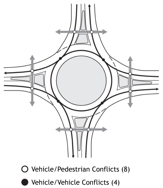
12 Total Conflicts
Source: https://www.fhwa.dot.gov/publications/research/safety/00067/000675.pdf
WYDOT studied a full range of traditional and innovative intersection solutions. They were ranked based on their safety, traffic operations, and driver expectancy. Those that did not rank highly in these categories were eliminated from further study.
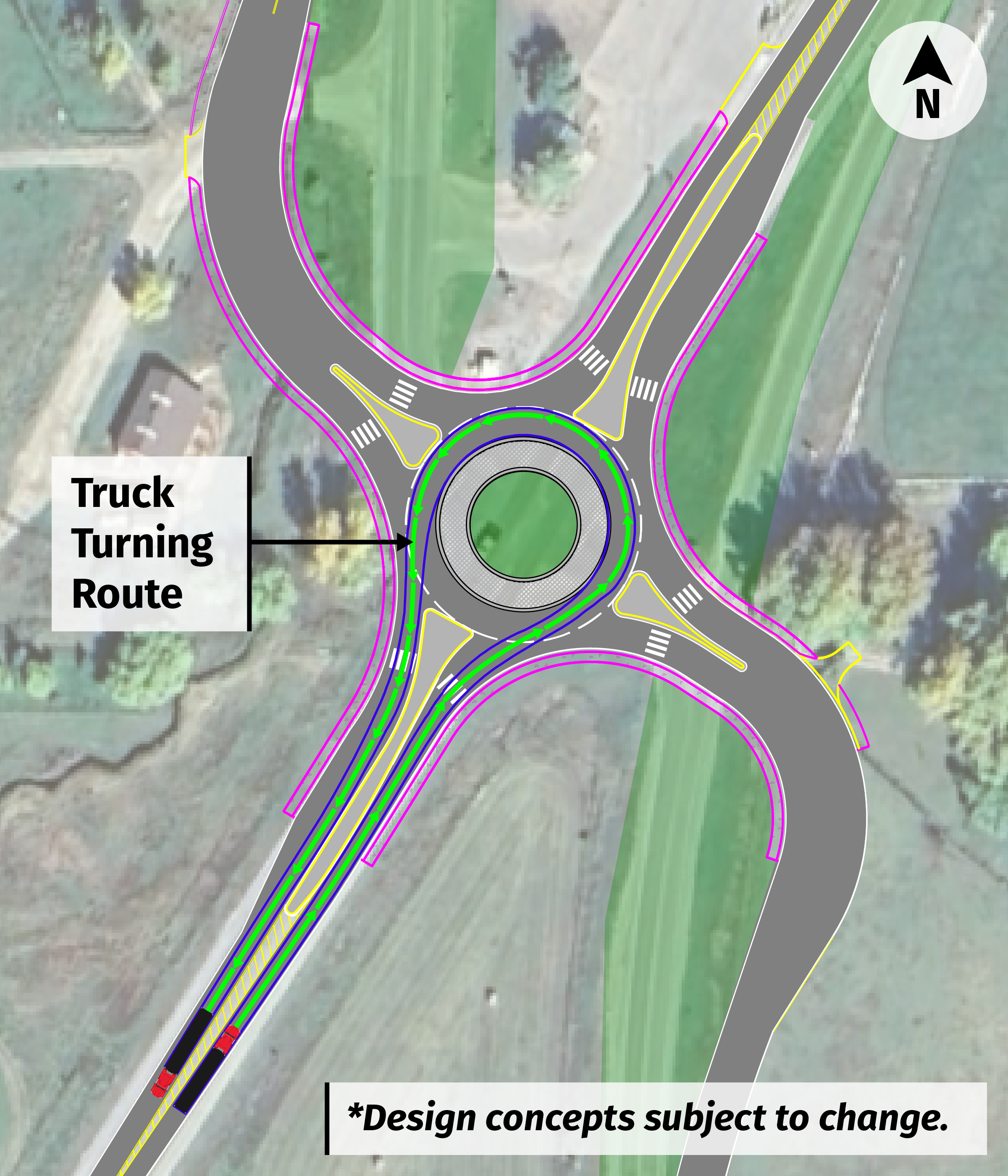
Yes, trucks and trailers can travel through roundabouts.
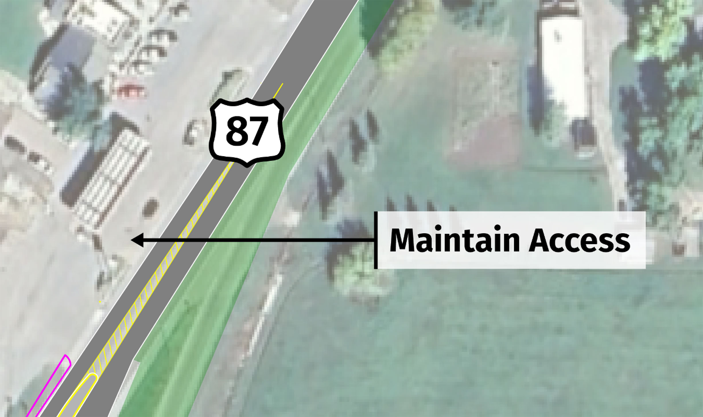
Access to the Big Horn Y Gas Station will be maintained, and specific access modifications would be determined during the design phase.

After clicking the button below to enter the online meeting: